Showing posts with label satellite images. Show all posts

Friday, October 10, 2014

Map rugs

First we found woodcut maps
Then quilted maps
Then map carpets
(And don't forget the airport terminal)
Now we have map rugs: Area rugs by Florian Pucher based on satellite images, mostly of farmland:


Sunday, July 13, 2014

Breathe easier

NASA satellite images released this week in animated GIF form show how air pollution has decreased across the United States over the past decade.
Nitrogen dioxide pollution, averaged yearly from 2005-2011, has decreased across the United States. Image: NASA Goddard's Scientific Visualization Studio/T. Schindler

Friday, May 23, 2014

Breathing Earth

What would it look like to get rid of the clouds and watch a time-lapse of the Earth go through a year's worth of seasons (minus the sea-ice)? Data visualizer John Nelson’s Breathing Earth shows us.


Saturday, August 31, 2013

A Judge Parker kidnapping (yawn)

Judge Parker mentions a map in their plotline about Neddy’s friend having been kidnapped in Niger. And, as is typical for soap opera comics, it's pretty boring. (why do they still exist?)


Wednesday, May 8, 2013

2 Berlins

One artifact of the division between East & West Berlin can be seen from space in the lighting of the different halves of the city:

Even more stark, of course, is the divide between North and South Korea:


But none of this should be a surprise because there are artifacts of human divisions from hundreds of years ago that still express themselves in various ways today.  Take this map of Poland that shows the electoral map of Poland in 2007 and the borders of the late 1800s - early 1900s German empire:

Or this map that shows areas of intense cotton production in 1860 and counties voting for Obama in 2008:


And there's more, always more, of this kind of thing.


Wednesday, January 30, 2013

Timing

Winter in Foxtrot, by Bill Amend:

Trying to mess with Google Maps satellites (which, for most urban areas in the US, are actually independent companies flying aerial photography that they sell to Google) is a recurring theme in comics recently.  Some examples:


Friday, November 9, 2012

...make good neighbors?

While it's not actually very easy to see The Great Wall of China from space, there are walls that are visible form space.  This image is a night-time view of the border between India and Pakistan where there is a big, floodlit fence designed to keep out smugglers and arms trafficking.  NASA's Earth Observatory has more.


Friday, September 28, 2012

Satellite starrys

NASA has selected what they think are this year's prettiest Landsat images,  The winner: Gotland, a Swedish island in the Baltic Sea.

There are a lot more beautiful satellite shots at NASA and USGS sites.

and an article with embedded videos at Slate.com

Thursday, April 19, 2012

Questionable story arc two-fer

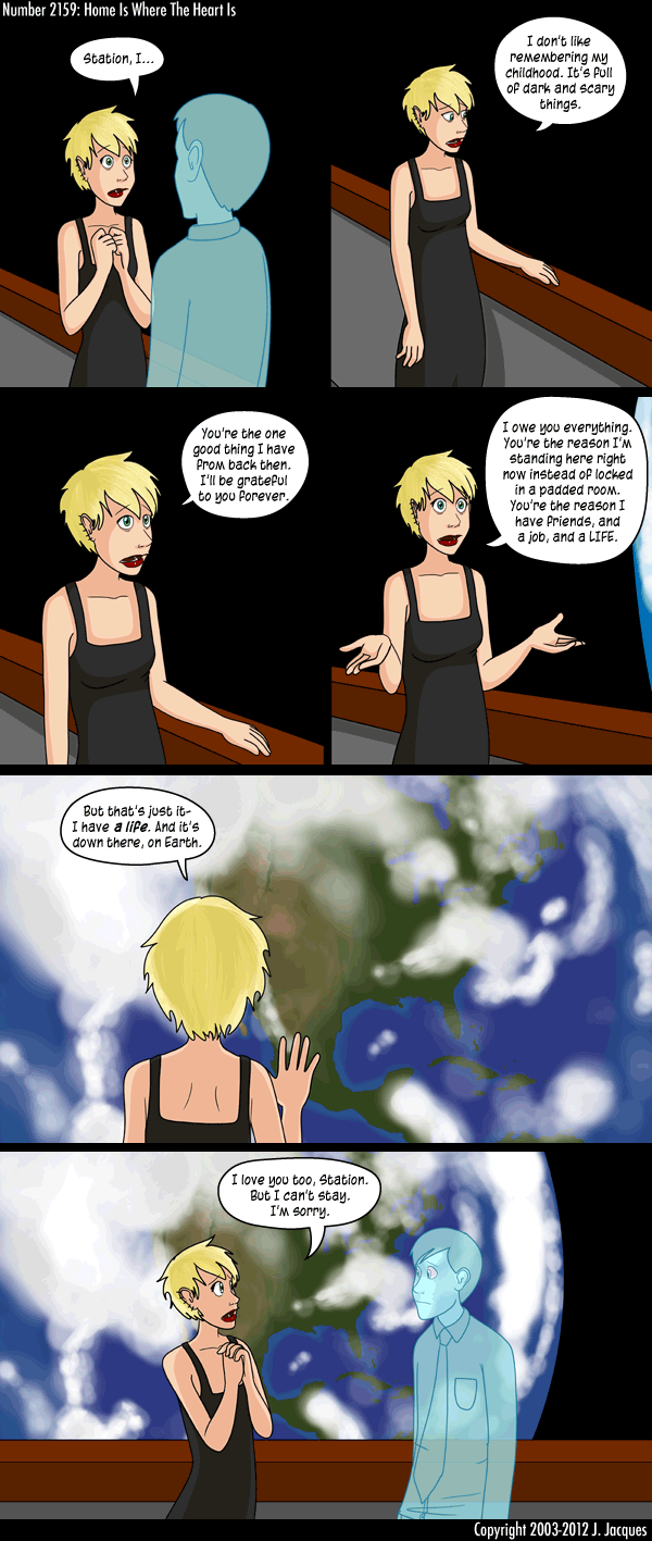
Since we did Thursday's animation on Tuesday we'll do the Tuesday two-fer today.  I introduced Questionable Content by J. Jacques. a few months back near the beginning of a space-faring story arc that seems to have now come to a close.  The entire rendering was punctuated by increasingly sophisticated spectacular images of the Earth out the space station windows.  I'll post the links to the entire story arcs below, but I just want to take a moment to post a few of the more wonderful examples:


http://questionablecontent.net/view.php?comic=2119: Barely visible through a window
http://questionablecontent.net/view.php?comic=2141: It does kinda look like he's showing a little rotation
http://questionablecontent.net/view.php?comic=2151: Africa still or again? Gotta be again


Friday, November 18, 2011

What in the name of Pei Xiu is that in China?

So this week there was a bit of a dust up as some extremely odd things were found in satellite images of China.  An article in Gizmodo (and other places) has more pictures, but not much in the way of explanation.  Anybody out there have any ideas?

Friday, November 4, 2011

Satellite collage art

I'll post this image in relation to last week's completion of the World Series:

Artist Jenny Odell scours through Google Maps and other satellite image repositories to put together these amazing collages of map art.  Check out more of her work on her personal page. It is immense fun.

Friday, August 12, 2011

De Nile at night

Nighttime photo of the Earth from the Space Station.  Can you figure out where on the planet this is (without looking at the post's title of course)? 

Tuesday, January 25, 2011

South Park snake


These are from the South Park episode "Summer Sucks" from way back during the 2nd episode. Compare this to the much more recent map from the 14th season in yesterday's post and see the marked improvement in cartography... but then the quality of all the animation in South Park has generally improved over time.

Monday, January 3, 2011

Water, water everywhere

Let's start the year with Jim Toomey's Sherman's Lagoon.  For some reason the mindless tossing of the Earth ball in this strip makes me happy, even if the joke in the comic is mean.

Wednesday, October 13, 2010

Google Earth on a diet

Marty Bucella gives us this comic here combining dieting and maps. There's been one other post that does that so far.  I gotta say I find this type of joke to be a symptom of dangerously psychotic body image issues, not funny.  

Friday, September 10, 2010

Ready for my close-up

The Book of Biff, that fantastic surrealist webcomic by Chris Hallbeck. Like the first Biff post, this one also deals with a scale gag. I'm sure this derived from the artist's concept of Google Earth's collection system, however in truth almost all urban "satellite images" seen on Google Earth and the other internet mapping sites are aerial photos.

Thursday, May 27, 2010

Brett Farve

This is sports-oriented editorial cartoon by Joe Heller ran in September of 2007 when Brett Farve was riding high with the Green Bay Packers.  Much has changed since then.  There's no way cheeseheads would be this dedicated to Farve any more.

Thursday, January 7, 2010

Adam discovers Google Earth 06

The end.

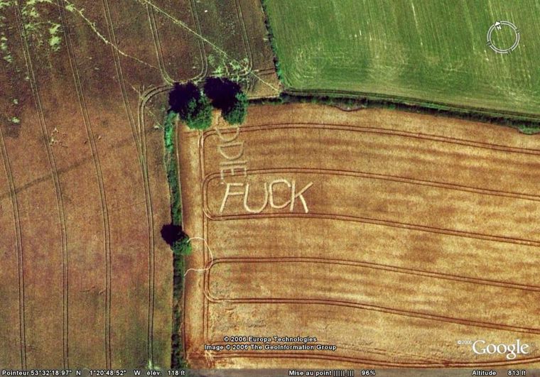
I think I may have made this point before.  If I haven't I'm making it here: Commercially available satellite imagery cannot show such high resolution.  Some aerial imagery can (i.e. photos taken from airplanes).  Most of the imagery seen of urban areas in developed nations on online mapping sites is from aerial photography, not satellite imagery.

Brian Basset's Adam@Home

Wednesday, January 6, 2010