

Showing posts with label Blue Sky GIS. Show all posts
Showing posts with label Blue Sky GIS. Show all posts
Monday, November 30, 2015
Paris this week
To coincide with this week's international climate change talks in Paris Amanda has submitted this explainer comic by Richard Monastersky & Nick Sousans:


Thursday, November 26, 2015
Wednesday, November 25, 2015
At the center of it all
Architecture critic Oliver Wainwright recently went to North Korea and took photos of colorful, symmetrical building interiors. One of them included this North Korea-centric wall map.
Tuesday, November 24, 2015
Mapping terror
Here's a video animation of 15 years of terrorist attacks by designer Milan R. Vuckovic. Is it more or less discomfiting than this animation of the history of nuclear tests?
Sunday, October 25, 2015
Friday, October 23, 2015

Thursday, October 22, 2015

Wednesday, October 21, 2015
Introducing Atomic Robo
Atomic Robo is a webcomic about an atomic-powered robot invented by Nicola Tesla. It often has maps. This one is funny because it shows a character using a map like it's a mall directory rather than the map of the black market freighter in the middle of the Pacific as our heroes/fugitives prepare to re-assemble the titular character and (once again) save the world.

Other examples:


Other examples:
Tuesday, October 20, 2015
Mercator truth
Many people have become so used to seeing the Mercator projection of the Earth that there's some confusion about actual sizes of different places on the planet. Here's an interactive tool to help clarify things.

...and an article to help explain what's going on
...and an article to help explain what's going on
Sunday, October 18, 2015
Rule 34
This might be a trigger warning for some. And if you don't know about Rule 34, here's the explanation


Saturday, October 17, 2015
Friday, October 16, 2015
Thursday, October 15, 2015
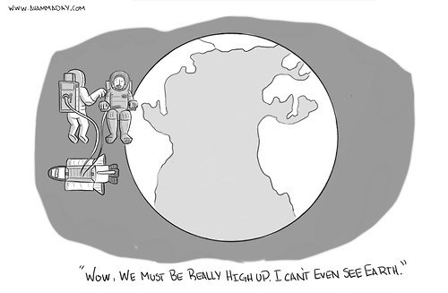
Really high
From Ahammaday.com. This one seems a bit off. Sure, the one astronoaut's looking the wrong way and his buddy is tapping him on the shoulder to turn around, but it just doesn't quite work somehow.
Wednesday, October 14, 2015
Relieving
This visual trope is a bit familiar (scroll to bottom of that link). This one is from an article about conservative Canadians screwing up privacy:

Tuesday, October 13, 2015
Jefferson Grid
Thomas Jefferson established the square mile as a foundation for land law in the US. This instragram account shows images of things found in 1-square-mile crops from Google Earth. It's pretty:


Sunday, October 4, 2015
Introducing OGLAF (Very NSFW)
While this particular example isn't too off-color, virtually every other episode of this webcominc, OGLAF.com, is massively NSFW:

Saturday, October 3, 2015
Friday, October 2, 2015

Monday, June 15, 2015

Sunday, June 14, 2015

Subscribe to:
Posts (Atom)