Friday, October 31, 2014
Maps of zombie escape routes
Toronto studio Design Different sells these maps of escape routes to zombie safe zones for various cities around the world. They’re actually an environmentalist message about the value of state forests and national parks around the world.
Thursday, October 30, 2014
Neutrinos & GPS
Here's a GPS mention in an older xkcd strip by Randall Munroe
The "title-text" at the actual webcomic says:

And while we're at it, we should mention that the Nobel Prize in Physiology or Medicine went to some scientists who discovered how the brain understands where the body is, i.e. the brain's GPS.
The "title-text" at the actual webcomic says:
I can't speak to the paper's scientific merits, but it's really cool how on page 10 you can see that their reference GPS beacon is sensitive enough to pick up continential drift under the detector (interrupted halfway through by an earthquake).
And while we're at it, we should mention that the Nobel Prize in Physiology or Medicine went to some scientists who discovered how the brain understands where the body is, i.e. the brain's GPS.
Labels:
Blue Sky GIS,
GPS,
neutrino,
physics,
Randall Munroe,
xkcd
Wednesday, October 29, 2014
Going crazy
This is Arlo and Janis by Jimmy Johnson. I'm not sure why she's having any confusion She seems to be pointing in relatively the correct directions to match her app.
Labels:
app,
Arlo and Janis,
Blue Sky GIS,
Jimmy Johnson,
navigation
Tuesday, October 28, 2014
Not London
This image was brought to us by friend Mary who provided an article in the London Evening Standard that caught the Falcons football team showing fans how thoroughly lost they'll make themselves on their way to an exposition match in London last weekend. Thank you Mary.

Labels:
Blue Sky GIS,
football,
London,
London Evening Standard,
lost,
Spain,
sports
Monday, October 27, 2014
Germany in the late 1940s (guest post)
Hello! Guest contributor Amanda Murphyao here, permanently derailing your regularly scheduled Monday morning world map cartoons with more images of Germany in these Herblock cartoons from the US Library of Congress:
Herblock - Now as we were saying - 17 May 1949
Herblock - Well, here we are again - 21 January 1947
Sunday, October 26, 2014
Saturday, October 25, 2014
US according to Okies
My friend Wendy posted this on Facebook a little bit ago. I'll re-post it here for those who didn't see it:

There are a lot of these types of "Views of the world according to..." map jokes:

There are a lot of these types of "Views of the world according to..." map jokes:
Friday, October 24, 2014
You bastards!
This is a Game of Thrones thing:

For reference:

For reference:
Labels:
bastard,
Blue Sky GIS,
fantasy,
Game of Thrones,
surname,
USA,
Westeros
Thursday, October 23, 2014
Ebolaids
So there's some unwarranted stereotyping here, but this does seem like what all the media hype is driving at:

Wednesday, October 22, 2014
Barak Obama: Time Traveller
Here's a photo of a guy sitting in front of a NYC transit map... and another photo of his younger self? Maybe he's a time lord?

Tuesday, October 21, 2014
Batch 'o New Yorkers
Here's a batch of map-related comics from recent New Yorker magazines:
 |
| Jack Ziegler |
 |
| Kim Warp |
 |
| Drew Dernavich |
 |
| Danny Shanahan |
Labels:
Blue Sky GIS,
Danny Shanahan,
Drew Dernavich,
fat,
geology,
god,
Jack Ziegler,
Kim Warp,
TED,
The New Yorker,
You are here
Monday, October 20, 2014
Germany is puzzling (guest post)
Hello! Guest contributor Amanda Murphyao here, officially derailing your regularly scheduled Monday morning world map cartoons with more images from Europe. This time, Germany in a cartoon from the US Library of Congress:
Edwin Marcus - "How do we fit this one in" - circa 1930-40?
Sunday, October 19, 2014
60+ Great Maps
Looking for something for the cartophilliac in your life? Here's Great Maps: The World’s Masterpieces Explored and Explained, by Jerry Brotton (and a review) with 60-some maps to ponder for hours on end.


Saturday, October 18, 2014
Cartophilia
We've mentioned other sites on the interwebs that are compilations of maps. Here's another on Pinterest by Christine L and some excerpts:

| Making Maps: Japanese Maps, Tokugawa Era, 1600-1870 |
Daniel Gray - Map of Tokyo for Computer Arts Magazine
| A Literary Map of Britain |
Friday, October 17, 2014
Live Fall colors map
Need to know the status of beautiful Fall foliage in your part of the US? Here's an interactive map that will show you from SmokyMountains.com

Thursday, October 16, 2014
The United [equitably populated] States of America
Last week Slate.com did a series on re-drawing the United States in order to get states of roughly equal population sizes. There have been various attempts at this. The one from urban planner Neil Freeman has been popular on the interwebs:

Slate came up with its own version, as well as more light-hearted versions, such as a division into 13 districts a la The Hunger Games and 4 states names after a popular Dr. Seuss classic:


The series went on to explore divisions based on sports players' homes, fast food/junk food joints, and other criteria. Perhaps the most fun is the interactive map that lets visitors click to see how much of the rest of the country is needed to comprise an area with the same population as, say, New York City.
Slate came up with its own version, as well as more light-hearted versions, such as a division into 13 districts a la The Hunger Games and 4 states names after a popular Dr. Seuss classic:
The series went on to explore divisions based on sports players' homes, fast food/junk food joints, and other criteria. Perhaps the most fun is the interactive map that lets visitors click to see how much of the rest of the country is needed to comprise an area with the same population as, say, New York City.
Among the questions this raises is whether such an equal-population-based division would disrupt some advantage that may currently exist in Congress due to the small-state, large-state interactions there. What, if any, are those advantages? Would rural communities'/citizens' interests be better served in the current system or one of more demographically equitable representation? Would this make the House operate more like the Senate?
All of this is somewhat different from the related question as to whether there should be more representatives per citizen in the first place. Most functioning democracies on the planet have a much, much higher ratio of representatives to citizens, around 1 representative per 100,000 rather than the USA's 1 per 700,000. Granted such a ratio would result in about 3000 representatives... but then the Founders had originally envisioned a ratio of about 1 rep per 50k - 60k residents which would've made for about 6000 representatives today. That seems like a distressingly large number of Congresscritters. However it could also make room for more third-party candidates from smaller congressional districts... and that could challenge the entrenched power of the two major parties and heaven knows the US political systems needs more competition.
Labels:
Blue Sky GIS,
demography,
Neil Freeman,
politics,
population
Wednesday, October 15, 2014
Maps in the style of Tolkien
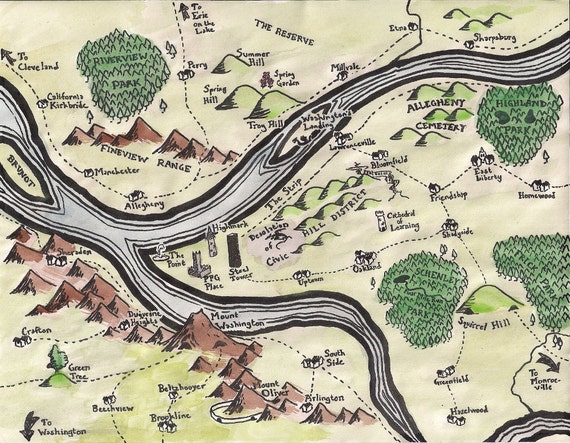
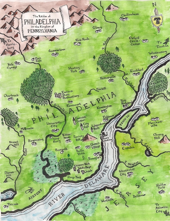
Mapsburgh sells delicate hand-cut paper street maps and fantasy maps in the style of Tolkien. They'll make one for any place you please:
 |
| Pittsburg |
 |
| Philadelphia |
Tuesday, October 14, 2014
Winsor McCay Changed the World
A couple weeks ago we posted some excerpts from the Dr. Seuss section of Masterful Marks: Cartoonists Who Changed the World. Here's another review of that compilation with images from all the sections including the section on Winsor McCay, who I already knew did the iconic Little Nemo comic. But I didn't know he drew the first-ever animated cartoon "Gertie the Dinosaur". the bird's-eye view drawings from the section below are compelling.

Labels:
artists,
balloon,
bird's-eye-view,
Blue Sky GIS,
history,
Little nemo,
Winsor McCay
Monday, October 13, 2014
Italy kicks butt (guest post)
Hello! Guest contributor Amanda Murphyao here, interrupting your regularly scheduled Monday morning world map cartoons to bring you some more images of Italy as (of course) a boot (as well as a sock):
Clifford K. Berryman, 4-10-1922
James Berryman, 7-26-1943
James Berryman, 7-30-1953
Jan Sluijters, De Nieuwe Amsterdammer # 149, Amsterdam, 3 November 1917
Clifford Berryman, 1915
John Collins, "Christmas Sock," The Gazette (Montreal), 26 December 1940
(Forgot to grab the full size image of this one while I was at the Library of Congress, but may be useful for other researchers to have this citation.)
The Economist, 8 January 2011, page 51
Labels:
adriatic sea,
Austria,
Bado,
boot,
Clifford K. Berryman,
Europe,
genoa,
globe,
Herblock,
Hitler,
Italy,
James Berryman,
John Collins,
Reg Manning,
sicily,
The Economist,
top hat,
world,
World War I,
World War II
Subscribe to:
Comments (Atom)


