
Sunday, June 30, 2013
Not Texas
Saturday, June 29, 2013
Friday, June 28, 2013
Amber Rousse's quilled map
Amber Rousse assembled this beautiful map of the world with curled paper
strips. Ms. Rousse also arranged mountain ranges to
relative heights and showed major ocean currents:


Thursday, June 27, 2013
Psychadelic M is for Map
Wednesday, June 26, 2013
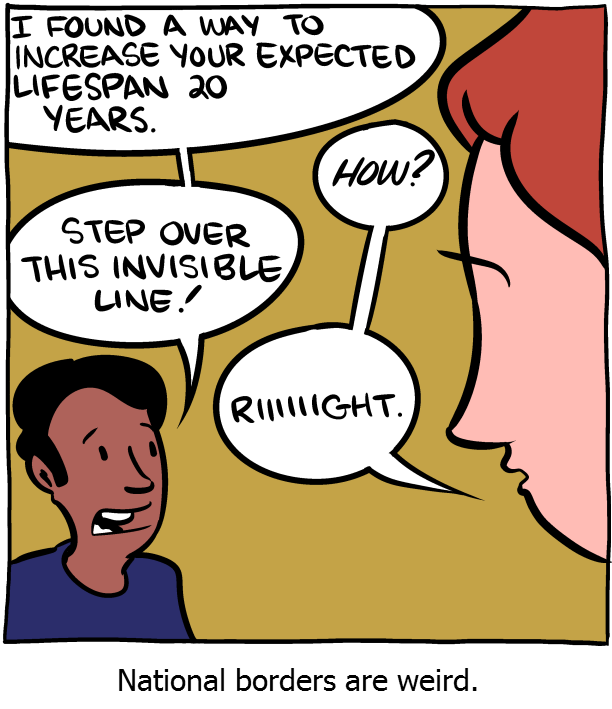
Borders are weird
Here's some fun with national borders from a recent Saturday Morning Breakfast Cereal webcomic by Zach Weiner. If you decide to stop over at the site there is this warning: SMBC is often NSFW.

Tuesday, June 25, 2013
Quite literally
What do place names in the vicinity of the USA mean? Here is a literalist translation map (interactive version and article here) of the USA and areas close to it designed by cartographers Stephan Hormes and Silke Peust,. I like that Mexico means "Navel of the Moon". That's pretty. A lot more poetic than the "United States of the Home Ruler".

Monday, June 24, 2013
Tennis anyone?
Here's an item by John Collins submitted by Amanda that's about the world getting itself back together after WWII and starting up The Davis Cup tennis championship.

Sunday, June 23, 2013
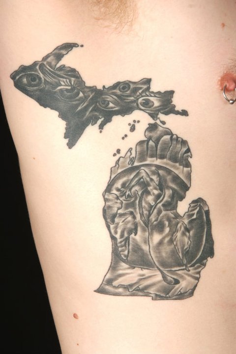
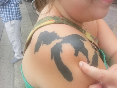
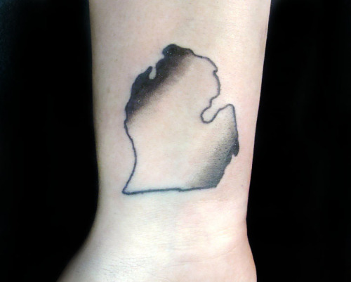
Michigan tattoo
Here's a lot of map-of-Michigan-themed tattoos ... which after a little internet search I think may be the most popular state to get tattooed on oneself. New Jersey is also popular. Wyoming and Colorado are very much not. As for the last one, I'm sorry if it's offensive to anybody, because it
was labelled as "impure Michigan", but I'm not quite seeing the
offense. I see a Michigan-inspired variation on the red-blue-whitespace
professional sports leagues logos. I understand where the offense could be coming from, however the orientation of the feet and legs don't lend themselves to that imagery.


Saturday, June 22, 2013
USA rivers
Nelson Minar has made this beautiful map showing all the rivers in the contiguous USA:
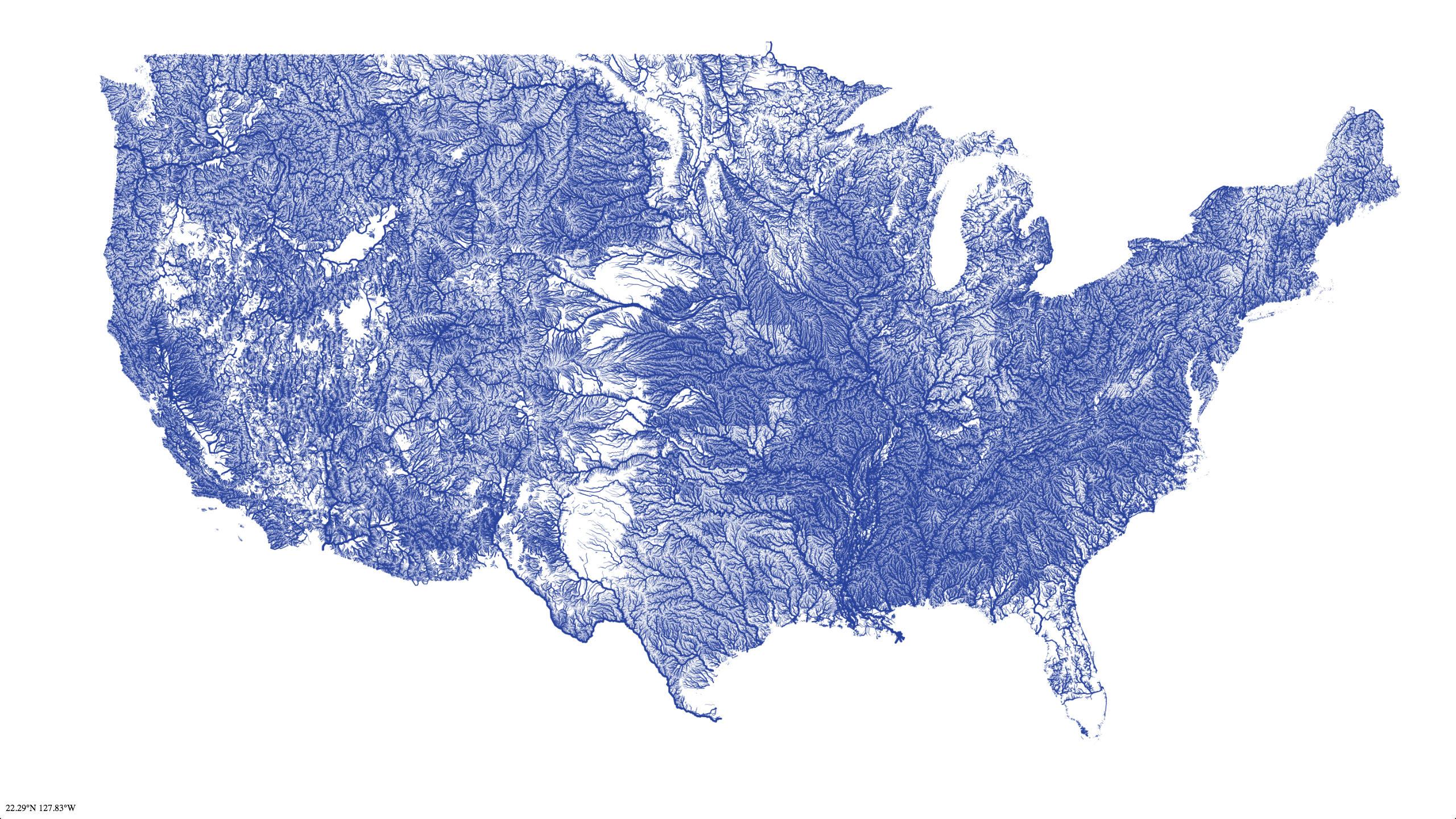
I recognize those empty, dry places there in Texas, Wyoming, and Utah. I already knew that some of the famously desert places west of there weren't as riverless as that. I'm a little bit confused about the riverless southern tip of Florida. My understanding was that, at least originally, that entire area from Lake Okeechobee south through the Everglades was effectively one giant tangle of rivers and streams. Here's it's shown as being as riverless (and by implication as dry) as West Texas. That's either nonsensical or very, very alarming.
I recognize those empty, dry places there in Texas, Wyoming, and Utah. I already knew that some of the famously desert places west of there weren't as riverless as that. I'm a little bit confused about the riverless southern tip of Florida. My understanding was that, at least originally, that entire area from Lake Okeechobee south through the Everglades was effectively one giant tangle of rivers and streams. Here's it's shown as being as riverless (and by implication as dry) as West Texas. That's either nonsensical or very, very alarming.
Friday, June 21, 2013
Stamen
Here's a tool called Stamen that lets you make maps using the Open Street Maps platform which is an open source mapping tool to rival the likes of Google Maps... although some of the big commercial webmaps actually use Open Street Maps.


Thursday, June 20, 2013


Wednesday, June 19, 2013
GeoGuesser
Some of you may have already heard about "GeoGuesser", created by Anton Wallén, the website that is a game where it shows you some random place on the planet in Google StreetView and you have to figure out where the place is. It went viral a few weeks ago. It can be pretty fun. Try it out:


Subscribe to:
Posts (Atom)